The River South Esk catchment and its communities experience flooding to varying degrees in both urban and rural areas. The catchment is impacted by fluvial flooding, i.e. from water courses, and pluvial flooding which is the result of surface run-off; rainfall which is unable to penetrate hard surfaces such as paving and tarmac. In addition, coastal flooding occurs when high flows from watercourses meet coastal waters, particularly during high tides. Coastal flooding affects areas of low-lying land such as that surrounding Montrose Basin.
The Tay Estuary and Montrose Basin Local Flood Risk Management Plan was co-produced by a range of partners to manage local and regional flood risk in the Tay Estuary and Montrose Basin, the latter of which is part of the River South Esk catchment. The Plan outlines actions to reduce the damage and distress caused by flooding; avoid and reduce the risk of flooding; and prepare and protect communities within vulnerable areas. Nineteen areas have been identified which are potentially vulnerable to flood risk in the Tay Estuary and Montrose Basin areas; two of which are within the River South Esk catchment:
- Montrose Basin (Potentially Vulnerable Area 07/04)
- Brechin (Potentially Vulnerable Area 07/05)
The town of Brechin has a long history of flooding, with the first recorded flood in 1774. In the 20th century six major flood events were recorded and following severe flooding in 2002, a flood protection scheme was planned for the River Street area in Brechin. The £16.3 million scheme was built in 2016.
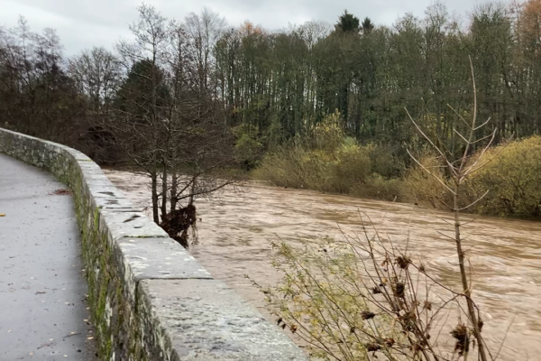
In October 2023, flooding which occurred in Brechin as a result of Storm Babet, was the most severe since November 2002. It is estimated that the flow rate of the river during Storm Babet reached 30% above the Flood Protection Scheme design capacity, with river levels rising to maximum of 4.6 m - some 90 cm above the flood scheme walls.
Storm Babet was the most significant storm event in recent history, with 19th October 2023 being recorded as the wettest day in Angus since records began in 1891.
The impacts of Storm Babet are still being felt in Brechin, as they are from other significant flood events elsewhere in Angus. Support for those affected by flooding can be found at the Flood Recovery Support and Brechin Beyond the Flood webpages, facilitated by Angus Council.
Together with hard engineering solutions, Natural Flood Management solutions are also delivered in the catchment. Natural Flood Management techniques aim to slow the movement of water by improving floodplain connectivity, creating permanent water storage in enhanced wetland areas, restoring peatlands and by improving water infiltration through tree planting. Following Storm Babet, Natural Flood Management opportunity studies have been commissioned by Angus Council, and the River South Esk Catchment Partnership hope to contribute to this work through catchment-wide opportunity-mapping and the second catchment management plan (due for publication in 2026). Information on completed and ongoing projects within the catchment can be found on the Projects page.